[+++ATTENZIONE+++ A causa dei danni causati dal maltempo, che non sono gestibili dai soli volontari, si sconsiglia di intraprendere il sentiero a persone inesperte e/o mal equipaggiate.]
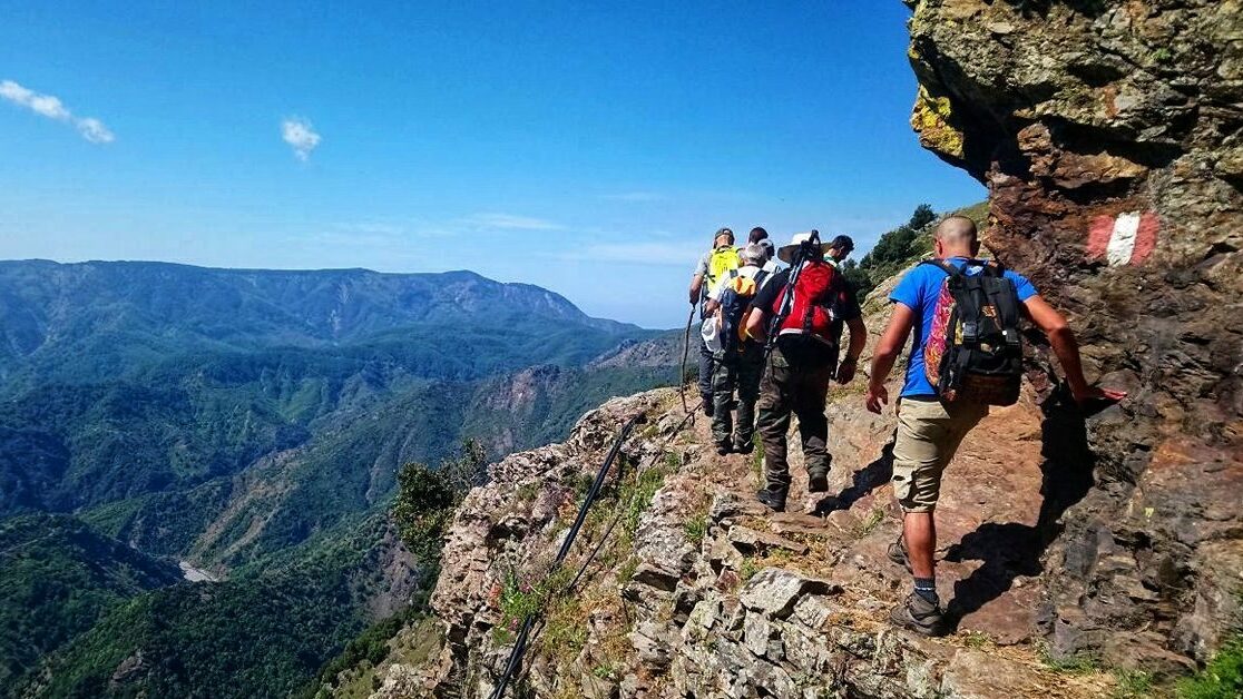
Il Sentiero dell’Aquila è un percorso ad anello che avvolge la città di Scilla come in un accogliente abbraccio.
Partendo dalla piazza centrale del paese, piazza San Rocco, proseguiamo su via Umberto I, anche conosciuta come via San Marceddinu o via di Cajoleddhi, e ci spingiamo giù fino (tenendo la destra per intercettare il sentierino all’inizio del muretto basso) ad un piccolo guado sul torrente Livorno. Il nome di questo torrente può apparire particolare, non ha infatti nulla a che fare con la città toscana! Livorno è il nome italianizzato dai cartografi piemontesi del torrente Urne (o Urni) e cioè le gurne, piccole vasche in cui ci si recava per mettere a mollo le piante che poi sarebbero state filate.
Percorrendo un piccolo sentiero tutt’ora utilizzato dai proprietari dei terreni circostanti, arriviamo dapprima a piano Utra e poi proseguiamo, superando una serie di semplici ostacoli, fino ad arrivare nel vallone Monacena, piccolo angolo di paradiso in cui cresce una rigogliosa vegetazione e dove incontriamo il primo punto d’acqua con la fontana di Medusa [aggiornamento al 2022: purtroppo la fontana Medusa è stata sepolta da un’alluvione e, attualmente, non è più visibile].
Seguiamo il corso del torrente, asciutto tutto l’anno se non nei giorni successivi a forti piogge, e spuntiamo su una comoda pista (sulla quale incontriamo il secondo punto d’acqua) che ci permette di arrivare a Puntone Cuddhucu (Cucullo sulle carte). Lasciandoci Cuddhucu alle spalle, tramite un sentiero tra i cisti, prima, e delle giovani querce da sughero, poi, arriviamo a lambire i piani di Bova e poi su fino a Monte Scrisi.
Da qui, tra piste sterrate e strade, arriviamo in falso-piano fino a Piano Aquile (che contribuisce all’attribuzione del nome) nella frazione Melia di Scilla, dove troviamo il terzo punto d’acqua.
Lasciando la strada e imboccando una sterrata sulla sinistra, scendiamo zigzagando lungo il fianco di Monte Iudice, senza mai perdere di vista lo spettacolare panorama su Stretto e Costa Viola, fino a giungere alla strada statale.
Adesso possiamo scegliere se visitare anche il borgo marinaro di Chianalea o imboccare le Scale sutta o Serru e tornare nuovamente in piazza.
Una versione alternativa prevede una deviazione su monte Selle (subito dopo il piazzale Padre Pio) per godere del magnifico panorama su Stretto e Costa Viola, il ritorno sul percorso di andata per circa 1,6 km e l’innesto sulla variante Catalimita svoltando a destra dopo il ricovero per animali in contrada Boccata.
[robo-gallery id=”1370″]
SCHEDA ESCURSIONE:
Tipo di escursione: ad anello
Difficoltà: E
Durata: 8,5 ore c.ca comprese le soste
Acqua potabile: a Piano Aquile (temporizzata in estate)
Dislivello: 850 c.ca
The Sentiero dell’Aquila is a loop trail that wraps around the city of Scilla like in a welcoming embrace.
Starting from the central square of the town, piazza San Rocco, we continue on via Umberto I, also known as via San Marceddinu or via di Cajoleddhi, and we go down (keeping our right to get the small track at the beginning of a roadside safety barrier) to a small ford on the Livorno stream. The name of this stream may seem peculiar, in fact it has nothing to do with the Tuscan city! Livorno is the name Italianised by the Piedmontese cartographers of the Urne stream (or Urni), i.e. the “gurne”, small tubs where women went to soak the plants which would then be spun.
Following a small path still used by some of the owners of the surrounding land, we first arrive at the Utra plain and then continue, overcoming a series of simple obstacles, until we arrive in the Monacena valley, a small corner of paradise where lush vegetation grows and where we meet the first water point with the Medusa fountain [2022 update: unfortunately the Medusa fountain was buried by a flood and is currently no longer visible].
We walk on the bed of the stream, which is dry all year round except in the days following heavy rains, and we emerge on an easy track (on which we meet a point of not drinkable water) which allows us to arrive at Puntone Cuddhucu (Cucullo on the maps) . Leaving Cuddhucu behind us, along a path between rock roses first, and young cork oaks then, we reach the plains of Bova, a perfect place to rest a little and enjoy a light meal, and then up to Monte Scrisi.
From here, between dirt tracks and roads, we arrive on a slight slope up to Piano Aquile (which contributes to the attribution of the name) in the hamlet of Melia di Scilla, where we find another water point, unfortunately not always running during summer.
Leaving the road and taking a dirt road on the left, we zigzag down the side of Monte Iudice, without ever losing sight of the spectacular panorama of the Strait of Messina and Costa Viola, until we reach the state road.
Now we can choose whether to visit the seaside village of Chianalea or take the “Scale sutta o Serru” stairs and return to the square again.
An alternative version sees you turning left towards Puntone Selle (right after piazzale Padre Pio), where you will enjoy one more stunning view on Stretto di Messina and Costa Viola, then back on your path for about 1,6 km and turning right after the goat shelter in Contrada Boccata, on the Catalimita trail.
Up here you can download both gpx tracks.
EXCURSION DETAILS:
Type of trail: loop
Difficulty: Medium/hard
Duration: 8,5 hours, including stopovers
Drinkable water: in Piano Aquile (timed in Summer)
Difference in altitude: 850 c.ca


